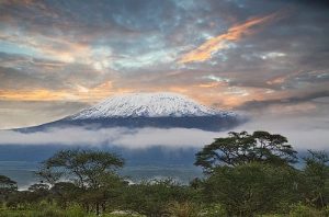
Navigating the Machame Route on Kilimanjaro
If you are planning to climb Mount Kilimanjaro, the Machame Route is one of the most popular and scenic options available to climbers. Known as the "Whiskey Route" due to its more challenging nature compared to the easier "Coca-Cola Route," the Machame Route is a great choice for those looking for a more adventurous trek up Africa’s highest peak.
Understanding the Machame Route Map for Climbers
Before embarking on your Kilimanjaro adventure, it is essential to understand the Machame Route map to ensure a successful climb. The Machame Route typically takes 6-7 days to complete, allowing for proper acclimatization to the altitude. The route starts at Machame Gate and ascends through various ecological zones, including lush rainforest, moorland, alpine desert, and finally, the arctic summit.
As you navigate the Machame Route, it is crucial to pay attention to the key landmarks and campsites along the way. Here is a breakdown of the Machame Route map for climbers:
Machame Gate (1,640m/5,380ft)
The journey begins at Machame Gate, where climbers register with the park authorities before starting the trek. From here, the trail leads through the dense rainforest, offering a glimpse of the rich biodiversity of Kilimanjaro.
Machame Camp (2,835m/9,301ft)
After a few hours of hiking, you will reach Machame Camp, the first overnight stop on the mountain. This campsite is situated in the moorland zone, providing stunning views of the surrounding landscape.
Shira Camp (3,750m/12,300ft)
The Machame Route continues up to Shira Camp, located on the Shira Plateau. This campsite offers panoramic vistas of the Great Barranco Wall and Mount Meru in the distance.
Lava Tower (4,640m/15,223ft)
As you ascend higher, the trail leads to Lava Tower, a massive volcanic formation that serves as a crucial acclimatization point. Climbers may experience mild altitude sickness symptoms here, so it is essential to rest and hydrate before descending to Barranco Camp.
Barranco Camp (3,950m/12,959ft)
Barranco Camp is nestled in the Barranco Valley, surrounded by the towering cliffs of the Great Barranco Wall. Climbers will tackle the infamous Barranco Wall the next day, a challenging but rewarding section of the trek.
Barafu Camp (4,600m/15,092ft)
The final push to the summit begins from Barafu Camp, the last campsite before the summit attempt. Climbers rest and prepare for the long night ahead, starting the summit ascent in the early hours of the morning.
Uhuru Peak (5,895m/19,341ft)
After a grueling climb, you will reach Uhuru Peak, the highest point on Mount Kilimanjaro. Enjoy breathtaking views of the surrounding glaciers and sign the summit register before beginning the descent back to Barafu Camp.
By understanding the Machame Route map and following the designated path, climbers can navigate their way to the summit of Kilimanjaro safely and successfully. For a memorable trek on the Machame Route organized by Sunset Africa Safari, contact info@sunsetafricasafari.com to book your adventure today.


