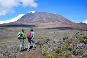
Navigating the Lemosho Route: A Comprehensive Map Guide
The Lemosho Route is a popular choice for hikers embarking on the journey to summit Mount Kilimanjaro, the highest peak in Africa. Known for its scenic beauty and varied terrain, the Lemosho Route offers a challenging yet rewarding experience for those seeking adventure. In order to successfully navigate this route, hikers must be well-prepared and equipped with a comprehensive map guide.
Understanding the Lemosho Route Terrain
The Lemosho Route is considered one of the longer and more scenic routes up Mount Kilimanjaro, offering hikers the opportunity to acclimatize to the altitude gradually. The terrain on the Lemosho Route varies from lush rainforest to rocky alpine desert, providing hikers with a diverse and ever-changing landscape to explore. As hikers ascend towards the summit, they will encounter challenging sections such as the Barranco Wall and the steep slopes of the Western Breach.
Navigating the Lemosho Route requires a good understanding of the terrain and a keen sense of direction. Hikers must be prepared for changing weather conditions, steep gradients, and high altitude as they make their way towards the summit. It is essential to have a reliable map guide to help navigate the route and stay on track throughout the journey.
Essential Map Features for Lemosho Route Hikers
When embarking on the Lemosho Route, hikers should ensure they have a comprehensive map guide that includes essential features to aid in navigation. Some key features to look for in a map guide for the Lemosho Route include:
Detailed Topographic Information
A detailed topographic map is essential for navigating the varied terrain of the Lemosho Route. Topographic maps provide hikers with information on elevation, terrain features, and landmarks along the route. This information is crucial for planning the hike, staying on track, and avoiding getting lost in the vast wilderness of Mount Kilimanjaro.
Route Markers and Waypoints
Route markers and waypoints are important for hikers to stay on track and navigate the Lemosho Route efficiently. These markers indicate key points along the route, such as campsites, water sources, and summit approaches. By following these markers, hikers can ensure they are on the right path and making progress towards their goal of reaching the summit.
Emergency Contact Information
In case of emergencies or unforeseen circumstances, having access to emergency contact information is crucial for hikers on the Lemosho Route. A comprehensive map guide should include contact details for local authorities, rescue services, and tour operators like Sunset Africa Safari, who organize tours on the Lemosho Route. This information can be a lifeline in times of need and ensure hikers can get the help they require quickly and efficiently.
In conclusion, navigating the Lemosho Route requires careful planning, preparation, and a reliable map guide. By understanding the terrain and essential map features, hikers can embark on this challenging journey with confidence and achieve their goal of summiting Mount Kilimanjaro. For those interested in booking a tour on the Lemosho Route with Sunset Africa Safari, please contact info@sunsetafricasafari.com to make your booking request.


